Hi! I'm Chin-Te (Calvin) Jung

An excellent GIS researcher
A solid developer
An effective big data analyzer with problem-solving skills

Specialities

  • Spatial Decision Support System
  • Ontology
  • Environmental Indicator Modeling
  • Spatial Analysis
  • Web GIS services
  • Spatial Data Infrastructure
  • Geospatial Web Application
  • Spatial Data Mining

Technical Skills

Client-sideAngular2, TypeScript, Gulp, Grunt, JavaScript ES6, jQuery, Angular.js, ionic, HTML5, jQuery UI, jQuery Mobile, Bootstrap, CSS
Server-sideNode.JS, Jenkins, Amazon EC2, Amazon S3, Python, Flex
DatabaseAmazon Dynamo DB, MongoDB, MS SQL
GISArcGIS REST API, ArcGIS Server, ArcPy, Leaflet API, OpenLayers API, GDAL Pyhton API, ArcObjects, Google Maps API, WMS, WPS, WFS, GeoJSON, KML
OtherScrum

Portfolio

GeoViewer

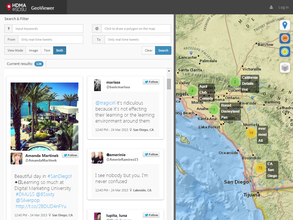
GeoViewer is a Web-based mapping application which provides the general public a window to see the ground truth of a topic and its changes in social media.

Techniques: jQuery, Bootstrap, ESRI mapping service, Leaflet API, Twitter streaming API, NodeJS, MongoDB

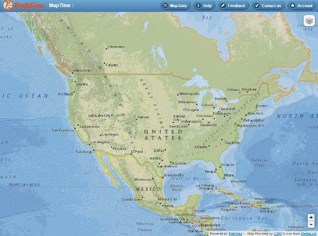
MapTime

MapTime is a Web-based mapping tool that allow users to geocode and geo-analyze their data (with street addresses) into maps.

Techniques: jQuery, jQuery Mobile, ESRI mapping service, Leaflet API, Python, MongoDB

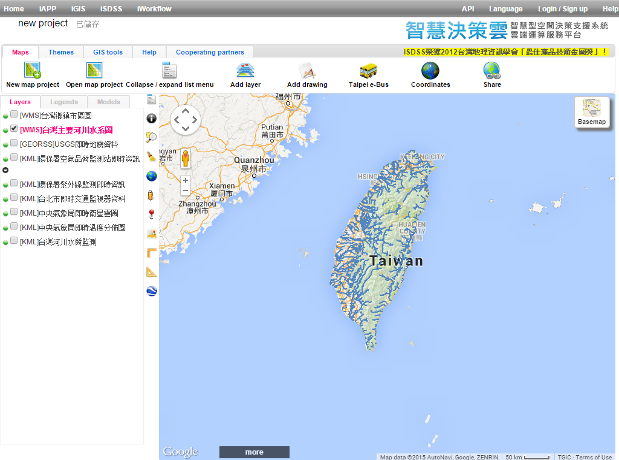
iSDSS

iSDSS is Taiwan GIS one-stop platform to search, visualize, and perform GIS web services (such as WMS, WFS, KML, and ArcGIS geoprocessing services).

Techniques: jQuery, jQuery UI, Google Maps API, ArcGIS Server, JAVA, MSSQL

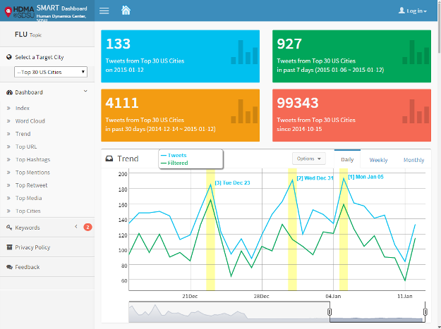
SMART Dashboard

SMART Dashboard is a Geo-Targeted search tool for Twitter messages to monitor the diffusion of information and social behavior changes.

Techniques: jQuery, Boostrap, ESRI mapping service, Leaflet API, Python, Twitter Search API, NodeJS, MongoDB

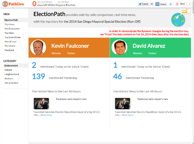
ElectionPath

ElectionPath provides side-by-side comparison, real-time news, with the top story for elections.

Techniques: jQuery, jQuery UI, Twitter Search API, Python, MongoDB

CA DUI Provider Map

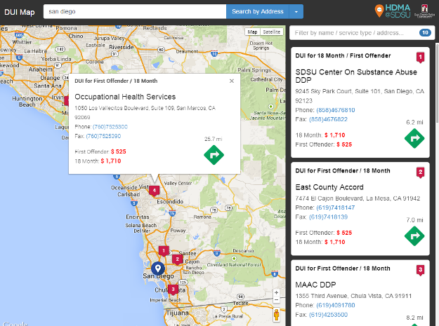
California DUI Map application provides users an Interface to query and show the nearest DUI (Driving under the influence) programs and providers.

Techniques: jQuery, Boostrap, Google Maps API, Google Fusion Table

Kuwait GIS Portal

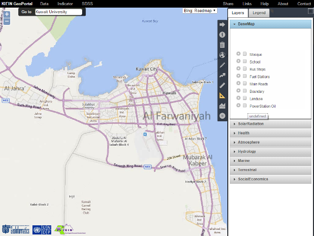
KIEIN GIS Portal is a GIS web-based application to visualize geospatial data in Kuwait.

Techniques: jQuery, jQuery UI, OpenLayers API, Bing Maps, Google Maps, Open Street Map, GeoServer, Python, Oracle Database

Professional Experience

Web Application Developer, Esri (Beijing) R&D Center

  • Developer lead of Survey123 Hub
  • Designed and implemented technical solutions to meet users’ requirements and to improve the productivity of development
  • Helped team members with screening and finding the right technical candidates
  • Collaborated with international teams for product release plans and software solutions
  • Had two presentations about how to use Scrum development on projects at 2016 and 2017 Esri China Dev Summit
  • Researched and designed technical solutions for new products

Chief Data Scientist, Center of Human Dynamic at the Mobile Age (HDMA), San Diego State University

  • Use NodeJS, jQuery, Leaflet API, ESRI mapping services, and MongDB to develop Web applications to present analyzed results from Twitter data
  • Use Node.JS socket to broadcast real-time tweets to users
  • Use spatial-temporal analysis and natural language processes to discover geospatial and linguistic patterns

Chief Technology Officer (CTO), PathGeo

  • Design and implement front-end Web applications and RESTful API using Node.JS, python, jQuery, Leaflet API, ArcGIS Mapping services, MongoDB
  • Create a Web crawler to crawl Facebook data
  • Use data mining methods (such as association rules and decision tree) to analyze Twitter and Facebook data
  • Amazon EC2 instance administrator

GIS Consultant, KISR

  • Lead, design, and implement a Web application by jQuery, OpenLayers API, ArcGIS Server, and GeoServer to show and perform environmental indicators
  • Provide geospatial analysis and problem-solving solutions

GIS Developer, UNDP (Duty Site: Kuwait Institute of Scientific Research)

  • Lead and design GIS web-based applications and Web services by jQuery, OpenLayers API, ArcGIS Server, SuperGIS Server, and GeoServer to visualize and analyze Kuwait geospatial data

Vice Director of Technical Division, Taiwan GIS Center

  • Lead and Design a GIS cloud application, similar to ArcGIS online, to collect, consume, and analyze geospatial Web services.
  • Project manager of the GIS cloud application
  • Use ArcGIS Server, SuperGIS Server, and GeoServer to publish GIS web services
  • Design and implement JS API with detail technical documents
  • Lead the team to earn the Best GIS Technology Award from Taiwan Geographic Society in 2012

Senior System Analyst, Taiwan GIS Center

  • Using multiple state-of-art geospatial technologies (such as ArcGIS Server, jQuery, Google Maps API, GeoServer, OpenLayers API, and ESRI mapping services) to develop Web applications
  • Use data mining to analyze the location suitability of convenience stores in Taipei city, Taiwan
  • Design and implement JS API with detail technical documents

GIS Research Assistant

  • Research and integrate ontologies in GIS to develop an intelligent and semantics-interoperable platform for the geospatial semantic Web

Education

National Taiwan University, Ph.D., 2013, Geography
National Taiwan University, M.Sc., 2005, Geography
National Taiwan University, B.Sc., 2003, Geography

Honor

Taiwan NSC PostDoc Program for 1-Year Scholarship
2014-2015 visiting scholar at San Diego State University, USA

The Best Oral Presentation of Young Researcher
2009 International Symposium on Digital Earth, Beijing, China

Japan Interchange Association Summer Program Scholarship
2009 visiting scholar at Tokyo University, Japan

Taiwan NSC Visiting Scholar Program for 1-Year Scholarship
2008-2009 visiting scholar at San Diego State University, USA

DAAD German Academic Exchange Service Scholarship
2007 visiting scholar at Hannover University, Germany

The Best Master Dissertation Award
2005 Taiwan Geographic Information Society
Publication

Selected Papers

  • Chin-Te Jung, Chih-Hong Sun, Min-Fang Lien, Chih-Shyang Chang, Wei-Jen Chung, Hong-Yang Lin, Ping-Ying Tsai (2013) MAKOCI: A Web Portal for Integration and sharing geographic information services, Geography, environment, and sustainability, 1(6): 37-54.
  • Chin-Te Jung, Chih-Hong Sun, and May Yuan (2013) Ontology-enabled framework for a geospatial problem-solving environment, Computers, Environment, and Urban Systems, 38: 45-57. [SSCI]
  • Wan-Kai Lee, Chien-yuan Lin, Chih-Hong Sun, Chin-Te Jung (2006) Development of a spatial conversion model for census data, Journal of Architecture, 59:127- 144.

Proceeding Papers

  • Chin-Te Jung, Chih-Hong Sun (2006) Development of a GIService based on Spatial Data Mining for Location Choice of Convenience Stores in Taipei City, Eds. Huayi Wu, and Qing Zu, GeoInformatics 2006: Geospatial Information Technology, Proceeding of SPIE, 6421:381-390.

Conferences

  • Chin-Te Jung, Chih-Hong Sun, Min-Fang Lien, Chih-Shyang Chang, Hong-Yang Lin, and Wei-Jen Chung (2012) MAKOCI: a GIS Cloud-based Web application for Open GeoData, 2012 CODATA, Taipei, Taiwan.
  • Chin-Te Jung, Chih-Hong Sun, Min-Fang Lien, Chih-Shyang Chang, Wei-Jen Chung, Hong-Yang Lin (2012) MAKOCI: a Web Portal for Integrating and Sharing Geographic Information Service, 2012 InterCarto 18 Conference, Smolensk, Russia
  • Chin-Te Jung, Dong-Po Deng, Tz-Han Schee, Chih-Hong Sun (2012) Open GeoData, 2012 Annual Conference of Taiwan Geographic Information Society, Taichung, Taiwan.
  • Chin-Te Jung, Chih-Shyang Chang, Chih-Hong Sun, Min-Fang Lien, and Wei-Jen Chung (2011) A Graphic Interface for Mashuping GI services—Use ArcGIS Server as an example, 2011 Annual Conference of Taiwan Geographic Information Society, Taipei, Taiwan.
  • Chin-Te Jung, Chih-Hong Sun, Min-Fang Lien, Wei-Jen Chung, and Chih-Shyang Chang (2011) MAKOCI: a GIS App, 2011 Annual Conference of Taiwan Geographic Information Society, Taipei, Taiwan.
  • Chin-Te Jung, Chih-Hong Sun, Min-Fang Lien, Tzai-Hung Wen, Joe-Air Jiang, Jehn-Yih Juang, Chih-Shyang Chang, Wei-Jen Chung, and Hong-Yang Lin (2011) Ontology-Based Multi-Agent Platform for Sensor Data Integration and Sharing, SWE2011 Conference, Banff, Canada.
  • Chin-Te Jung, Chih-Hong Sun (2010) MAKOCI: Multi-Agents Knowledge Oriented Cyberinfrastructure for SDSS, Asia GIS 2010 International Conference, Kaoshiung, Taiwan.
  • Chin-Te Jung, Chih-Hong Sun (2010) Ontology-driven Problem Solving Framework for Spatial Decision Support Systems, The 7th Taipei International Digital Earth Symposium, Taipei, Taiwan
  • Chin-Te Jung, Chih-Hong Sun (2010) An Knowledge-oriented Framework for Spatial Decision Support System, 2010 Annual Meeting of the Association of American Geographers (AAG-2010), Washington D.C., USA.
  • Chin-Te Jung, Chih-Hong Sun (2009) An Ontology Framework for Spatial Decision Support System, 2009 Annual Conference of Taiwan Geographic Information Society, Taichung, Taiwan
  • Chin-Te Jung, Chih-Hong Sun, Kuo-Chih Hong (2009) Development of an Ontology-based Framework for Geospatial Semantic Decision Support System, 6th International Symposium on Digital Earth, Beijing, China
  • Chih-Hong Sun, Chin-Te Jung, Fui-Yu Kuo, Wan-Kai Lee, Min-Fun Lien, Kuo-Chih Hung (2009) Development of an Ontology-based Service Oriented Architecture Framework for National Geographic Information System in Taiwan, GSDI-11 World Conference, Rotterdam, The Netherland
  • Chin-Te Jung, Chih-Hong Sun (2007) Applying Web GIS 2.0 on agriculture surveys, The fifth Taipei international digital earth symposium, Taipei, Taiwan.
  • Chin-Te Jung (2006) The Overview of GeoSemantic Web, Open GIS & Web GIS, Taipei
  • Chin-Te Jung, Chih-Hong Sun (2006) Model Suitable Locations for Convenience Stores in Taipei City with Decision Tree Analysis, 4th Greater China GIS Conference, Kunming, China
  • Chin-Te Jung, Chih-Hong Sun (2006) Development of a Web-based Spatial Decision Support System for Business Location Choice in Taipei City, ESRI User Conference 2006, San Diego, USA.

DISSERTATION AND THESIS

  • Chin-Te Jung (2013) KOCI: Knowledge Oriented Cyberinfrastructure for Spatial Decision Support System, Doctoral Dissertation, University of National Taiwan University, Taiwan.
  • Chin-Te Jung (2005) Spatial data mining on census data – a case study for location analysis of convenience stores in Taipei city, Master dissertation, University of National Taiwan University, Taiwan.